Sources and how to read this model
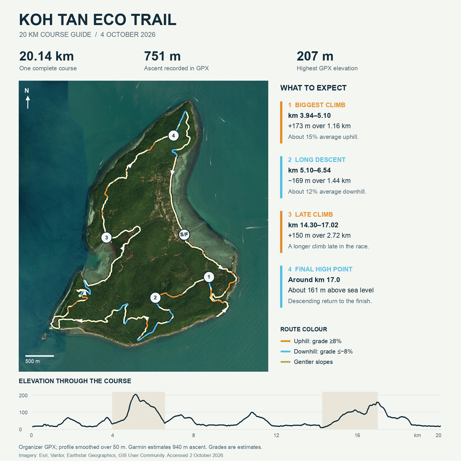
The organizer's GPX determines the route, distance and elevation profile. It contains 18,003 points. The displayed route is sampled every 10 m; the profile uses a 50 m moving average and grades use a 100 m window. The complete GPX returns to its start only at the end. Some short sections can overlap.
The surface uses independently measured terrain from Mapzen Terrain Tiles. The route follows the exact terrain triangles and is hidden where hills block the view; the elevation numbers come from the GPX. Sea elevations below zero are flattened to zero. Default height exaggeration is 2.5×; select 1× for true proportions. Grade and height are approximate, and imagery cannot establish footing or current trail conditions. Imagery acquisition dates were not supplied by this export.
Garmin recalculates elevation: 20.10 km, 940 m ascent, 944 m descent. The organizer GPX records 20.144 km, 751 m ascent, 749 m descent. These are different elevation methods, not a measured uncertainty interval.
Organizer post · Official GPX · Terrain source · Satellite source